During the sun last weekend Tom and I ventured out to stretch our legs and find some of the airplane wreckage on Bleaklow. On our list to find was the B29 Super fortress “over exposed”, a Lancaster KB993 and a C47 Skytrain. There is more wreckage besides on Bleaklow and in the rest of the Dark Peak area. Finding our planes would involve going off-path and walking through the peat bog area. We theorised with the lack of recent rain and the warm weather that the bogs may be dried up and easily passable.
We parked up at the lay-by where the Pennine way crosses Snake Pass and proceeded up the Pennine Way. Amusingly, within metres of starting along the Pennine Way we were greeted with the site of a duck paddling about in a bog at the side of the path, so much for our dry theory! There seemed to be plenty of other walkers about. After 500m or so along the path we turned left at the cross-roads to head along the Doctors Gate path down into the gorge.

During our descent along the rather muddy path to the bottom of the valley we only saw four other people, with how muddy the path was I could see why. At one ponit I managed to jump a fraction too short and sunk up to my knee in mud, still at least I kept my shoe.
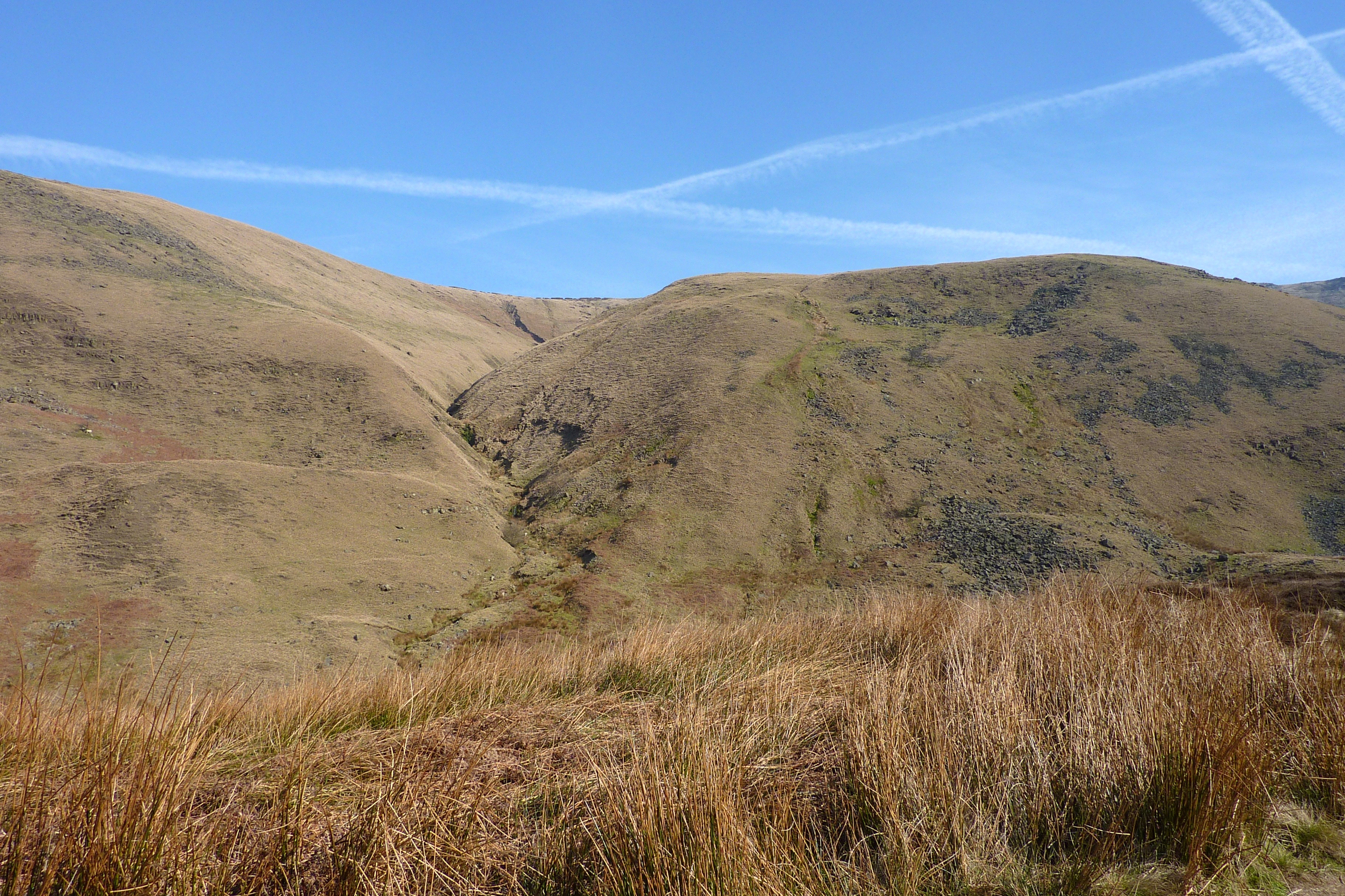
After drawing level with Ashton Clough, our planned route up to the top we decided against it – it looked really steep, possibly requiring a bit of a climb up a river bed. It rose 200m over 750m. Instead we walked on a little further and walked up the nice, dry hill to the side. This rose 200m over about 1100m which was still plenty steep. This side of the valley was south facing and was really dry, which was a nice relief. By the time I’d got to the top my mud covered leg had dried out.

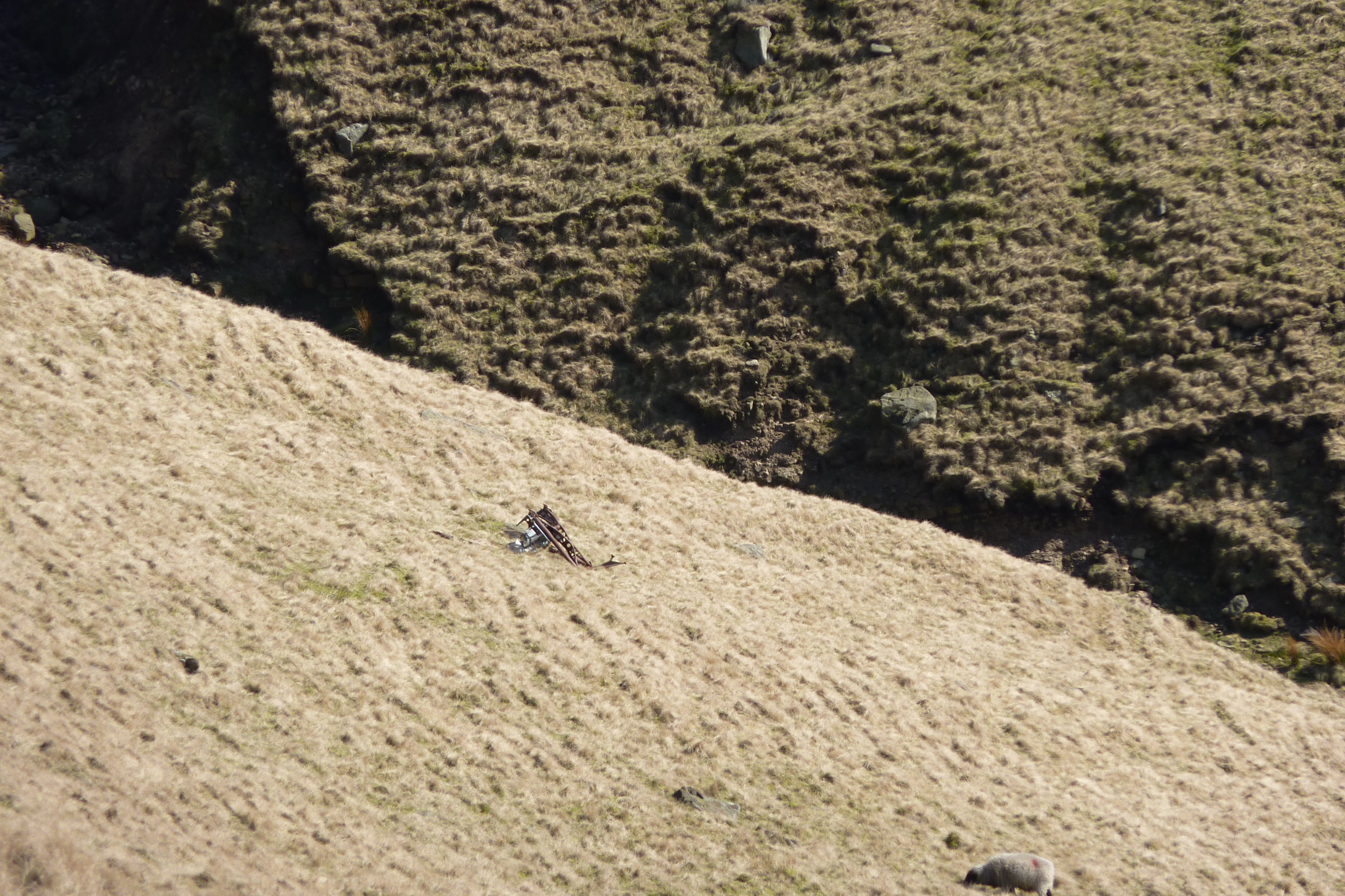
Most of the remnants of the C47 sky train were inside Ashtons clough which meant that we couldn’t see it, the odd bit wasn’t though. On our way up Tom spotted this, thankfully he had brought some binoculars.
Feeling refreshed now that we had reached the summit, we picked up the speed again and trotted West onto the summit of James’ Thorn. It was here that the search for Lancaster KB993 began. While wandering towards the cliff edge we had one eye ahead looking for wreckage and another in the sky, watching a helicopter. It was moving heather and sphagnum onto the moors as part of the moors to the future regeneration project. While wondering around, we found some fairly impressive tunnels in the bogs.

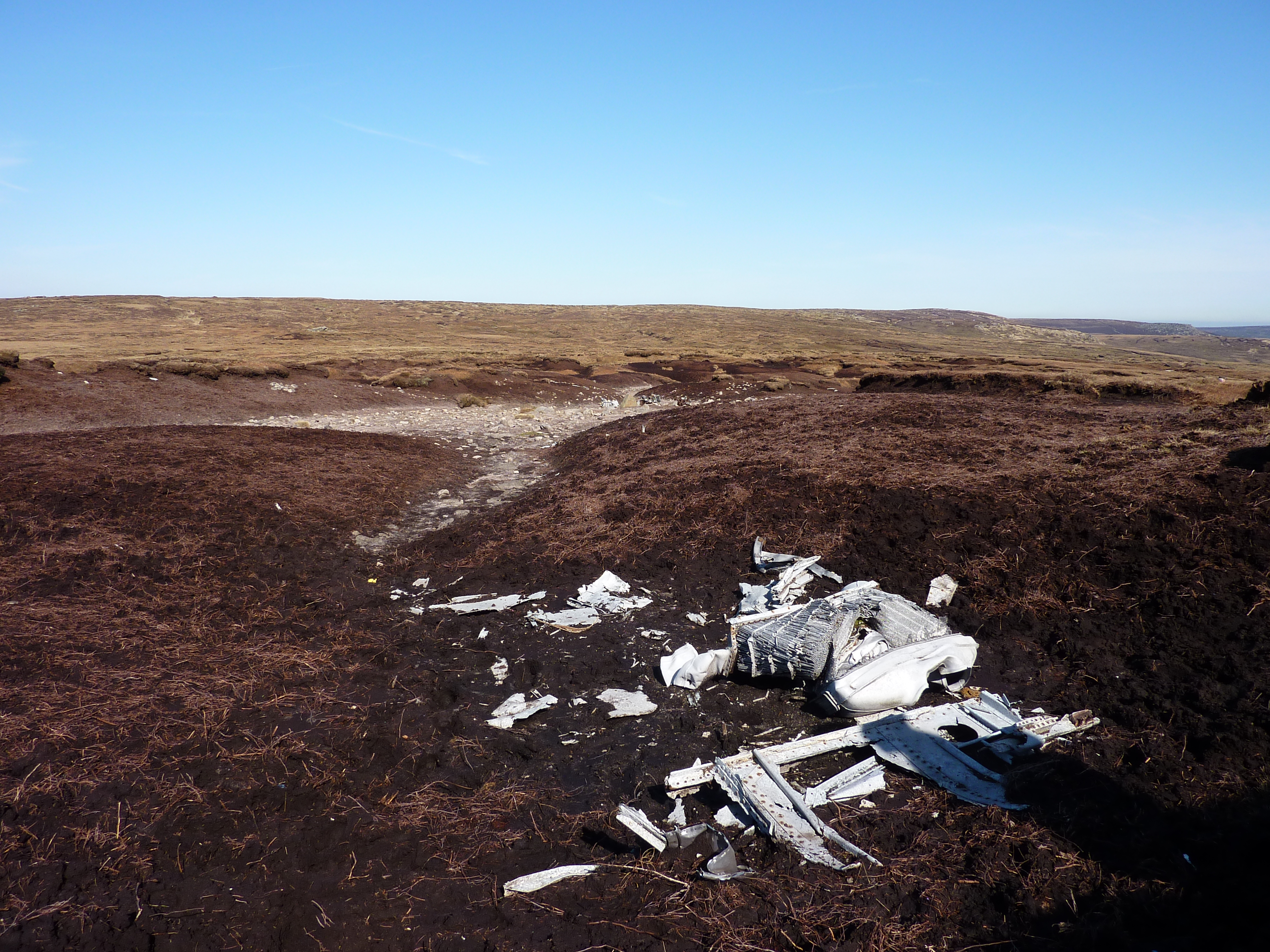
Eventually at the top of the cliff we found the crash site. It was pretty odd, the rest of the hillside was covered in grass, the crash site was just earth covered in tiny bits of unidentifiable bits of metal and glass. Most of the larger pieces of wreckage had been piled up together with some big stones. There was a memorial plaque to the crew of both the Lancaster and the C47 Sky Train spotted earlier. Someone must have gone to some effort to hump that across there.

Starting to feel peck-ish we marched on over to some nice, dry, comfy rocks at Lower Shelf Stones to eat our sandwiches and lounge around in the sun with a cooling breeze blowing over us. The viewpoint was inspiring, it was possible to see the river in the valley bottom, moorland to the north, east and south across to the Kinder plateau. To the west was a lot of haze, Glossop and the Manchester conurbation. Above us were lots of low flying aeroplanes banking during their descent to Manchester airport.
Rest over, we crossed more bogland on the way to Higher Shelf Stones in search of the B29, the biggest of the planes to crash. The trig point at Higher Shelf Stones had the same moon-like quality I was familiar with from walking on Kinder Scout. It was here that we began to see people more and more often, if you looked all the way around there would often be someone within sight.
Just north east of the trig point we saw the biggest bit of aeroplane we’d found to date, we hurried on over and took photos.
Heading on around the corner from there, we were shocked with what we saw next
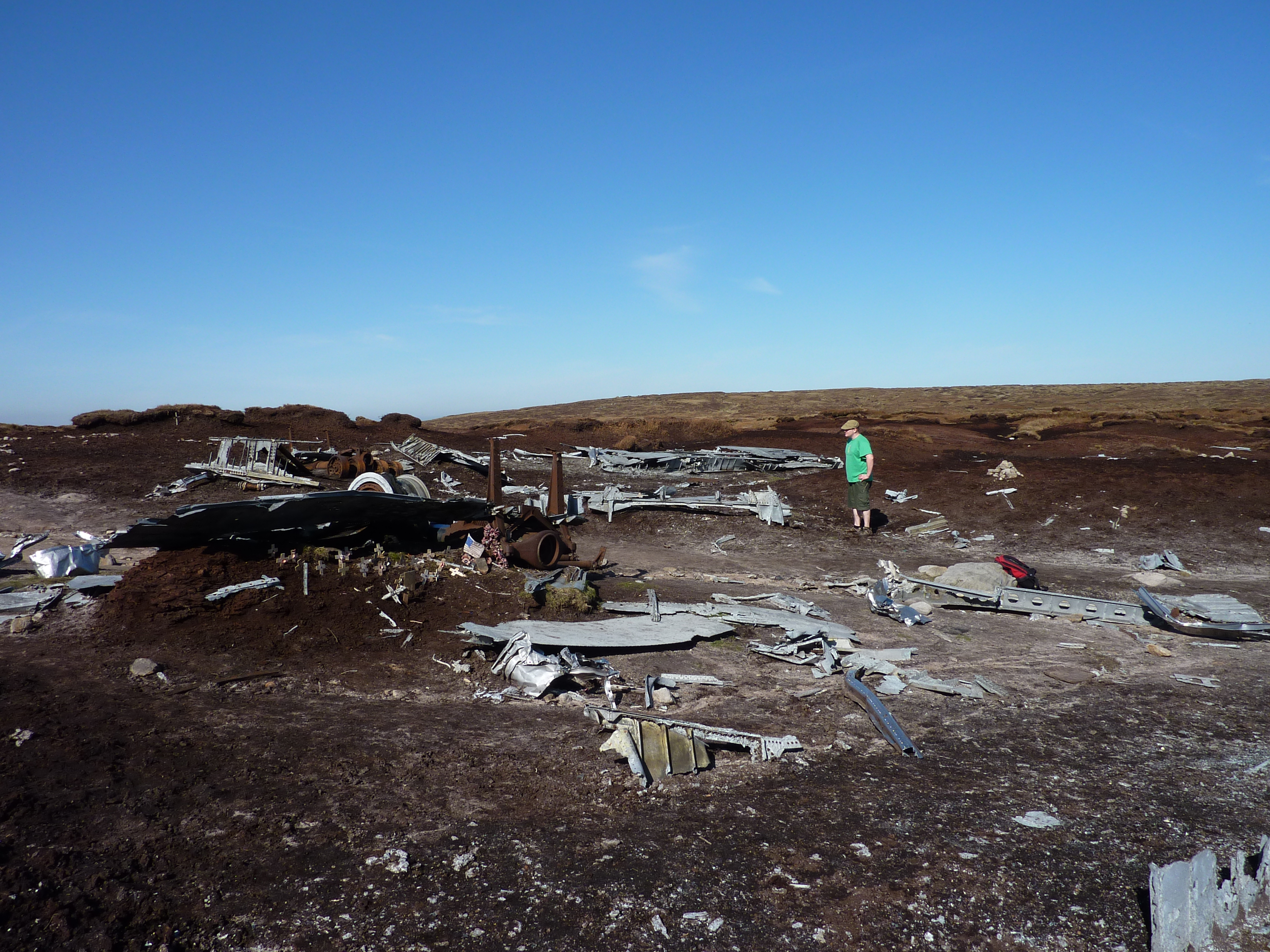
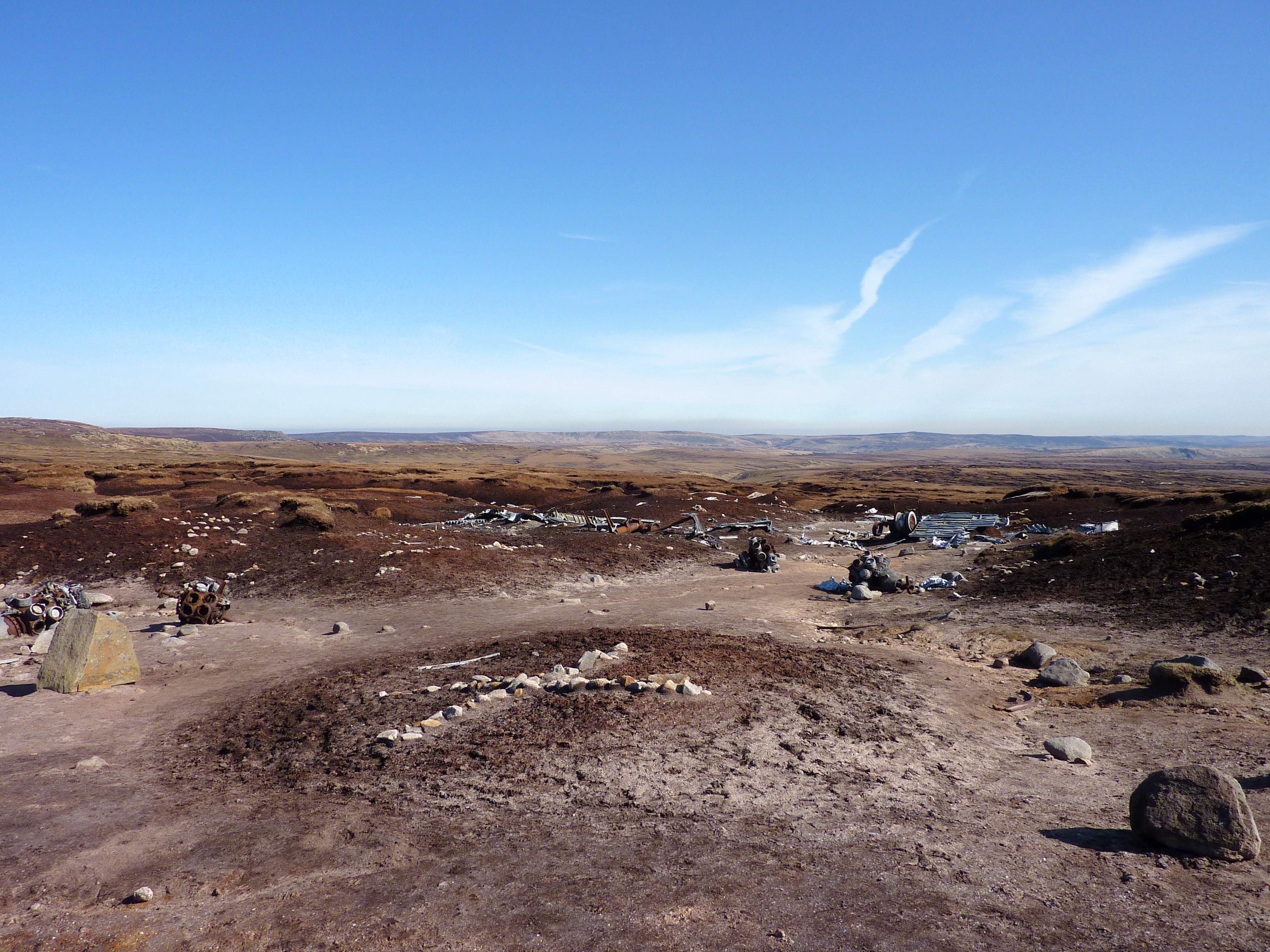

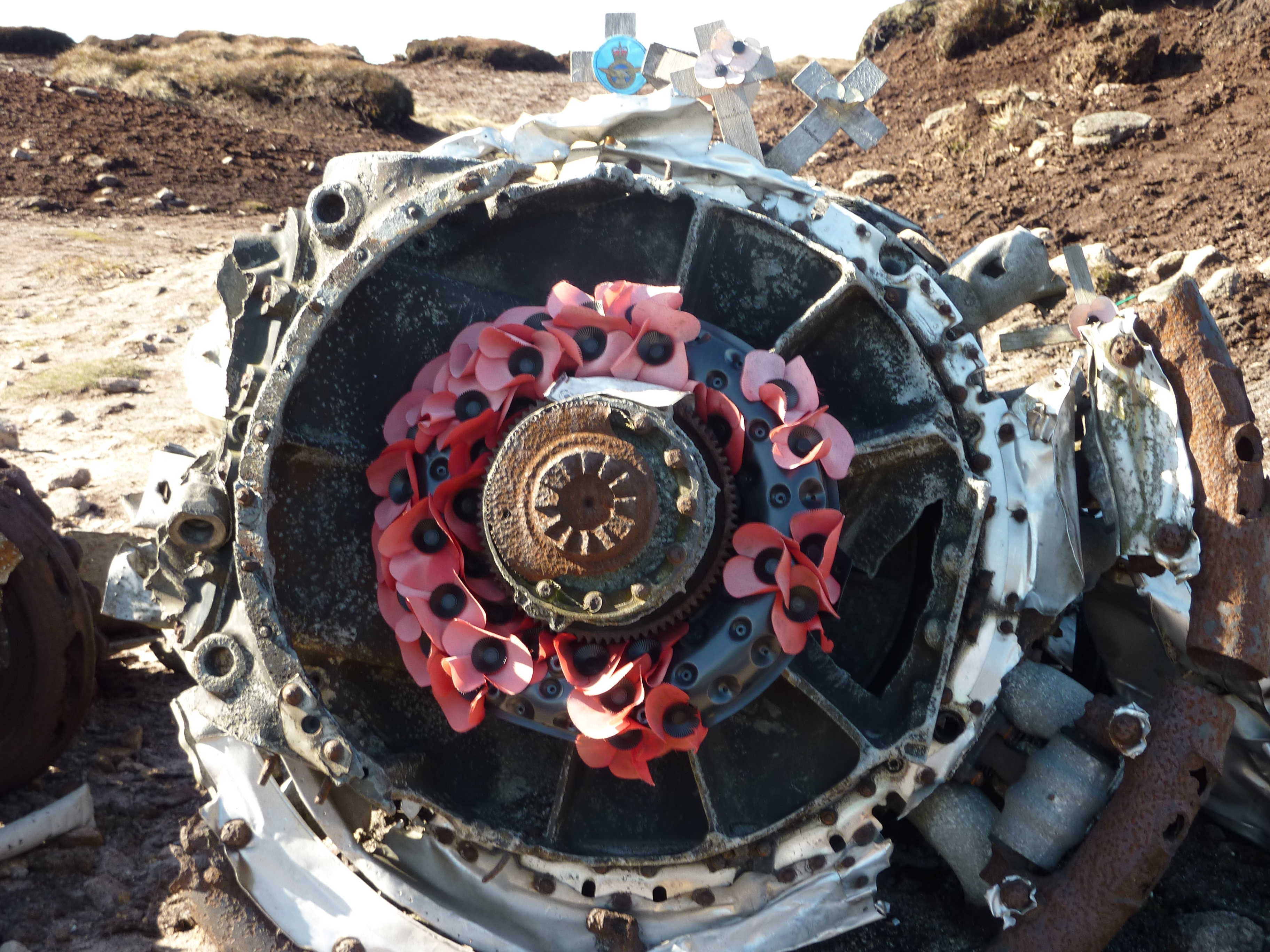
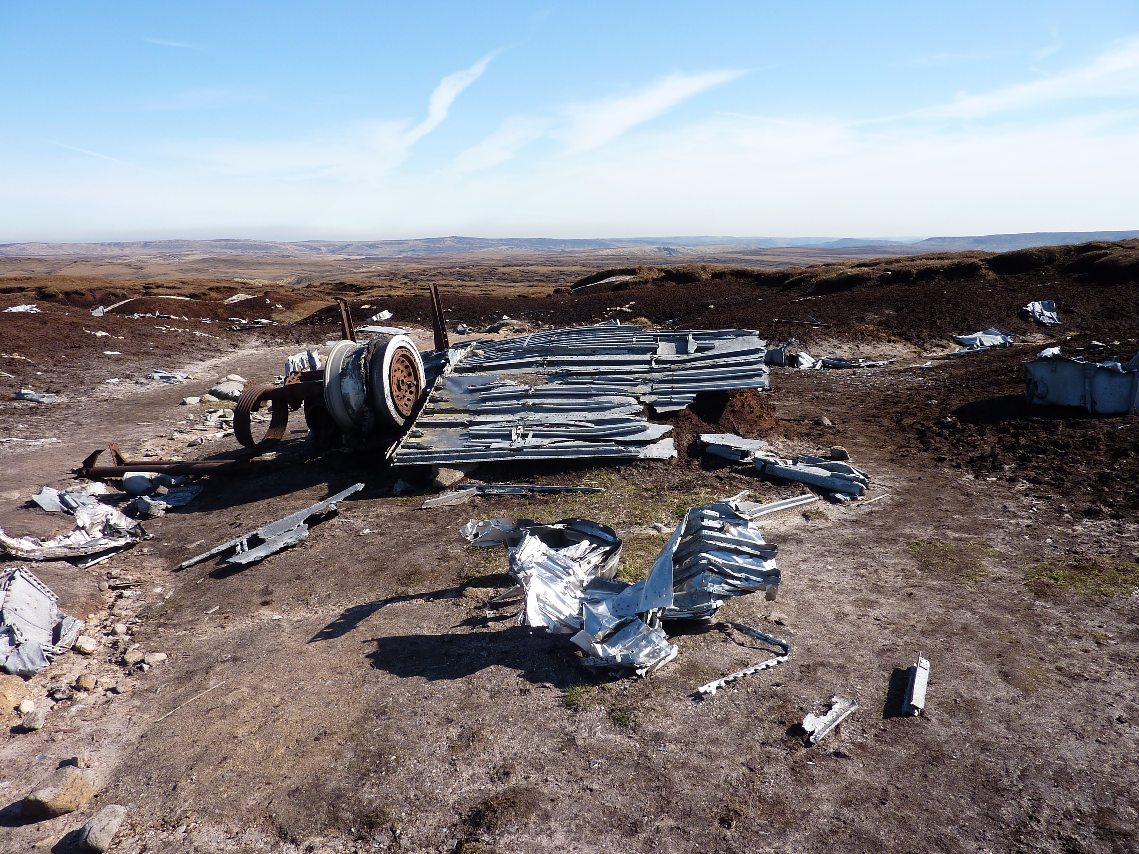
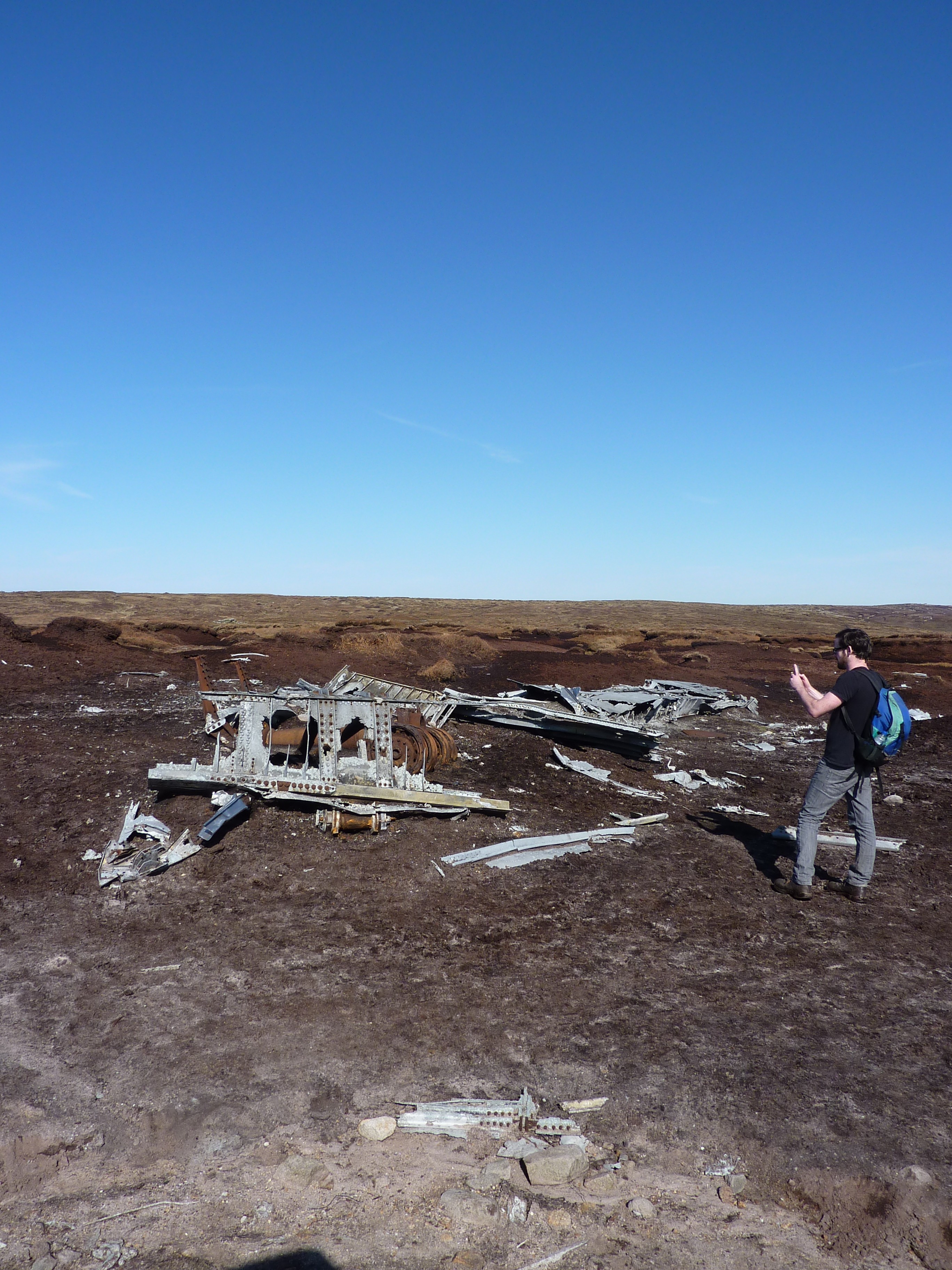
The wreckage was spread out over quite a wide area, and some of it seemed to be in surprisingly good nick, for the most part rust free, and some bits still had its green and black paint. Everywhere around the site were wooden crosses, poppies and stone crosses, there is also a memorial plaque for the crew that died during the crash. Mercifully it is thought that at least they didn’t suffer, they dropped out of cloud to get their bearings and instantly hit the ground.
After spending some time looking around the B29 wreckage, we headed east to catch back up with the Pennine way, being slightly further south than we had planned meant we pretty uneventfully had to cross two streams. We then sprang out of a peat channel onto the paved Pennine way, feeling like a pair of seasoned walkers and ambled south back to the A57.
There are a few more photos at http://www.flickr.com/photos/dsas/sets/72157629306884980/.

Leave a comment